Guides / Chamonix valley / Cruising blues

A blue-run day you can picture.

Best blue runs in Chamonix.

Choose one valley sector and make a few good laps. These four blue-run picks come with an exact-run video, a starting gondola and a way back that avoids a final ski descent to the valley. Les Houches and Brévent are separate outings: choose the lift before choosing your hotel.

4 blue-run choices · 4 matched run videos

Les Houches piste map · La Cha & Chamois ↗
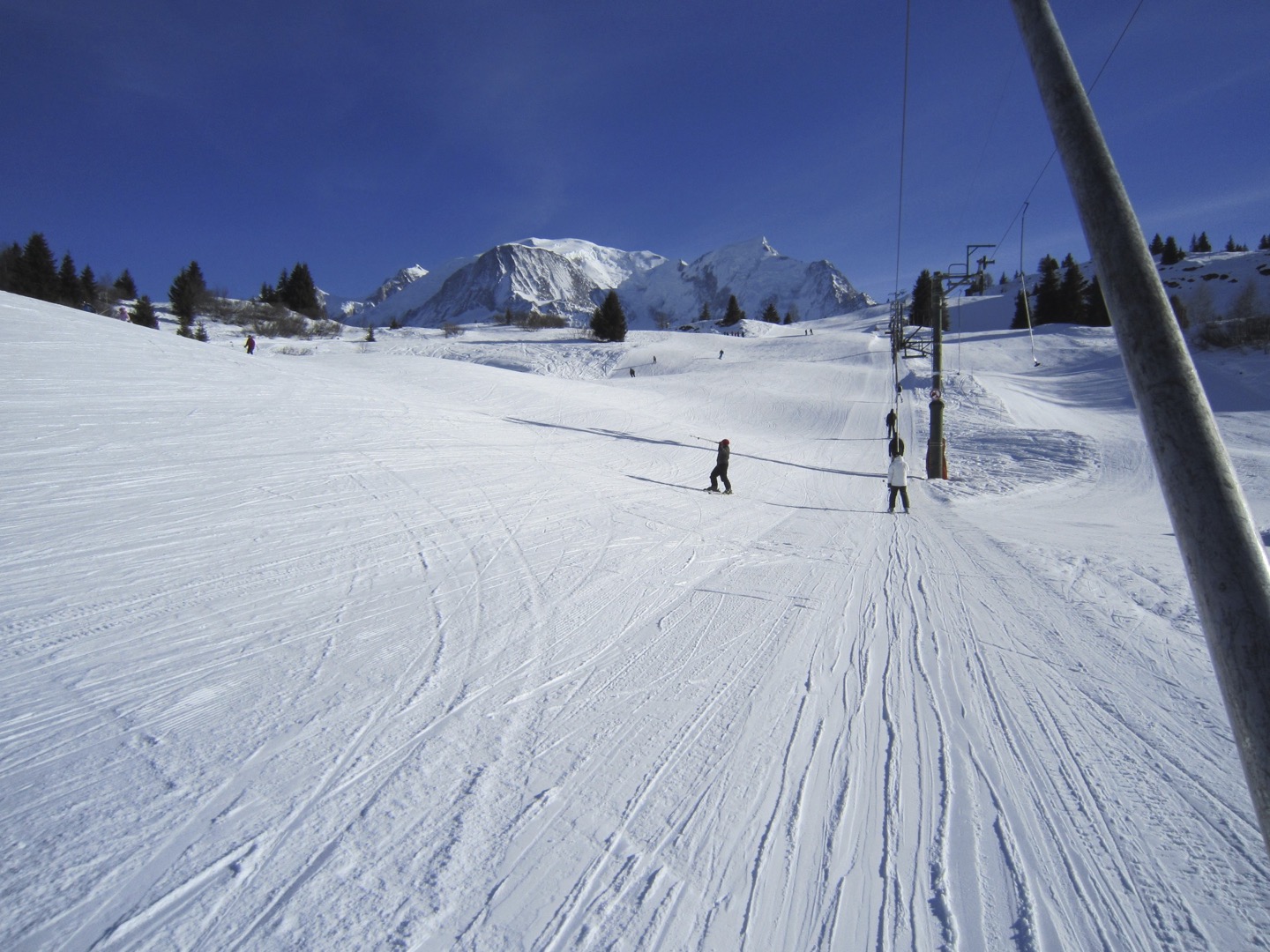
Skiers and a drag lift on snowy upper slopes at Les Houches, with Mont Blanc beyond
An archive winter view of the upper Les Houches ski area. The photographer did not identify a named piste; use the videos below to preview La Cha and Chamois.27 January 2011 · Resort / sector viewMincebert / Wikimedia Commons · Public domain · Full photo · Resized only

Choose a starting point and a finish.

Find the part of the mountain that suits your day.

These are separate outings grouped by sector, rather than a connected circuit or a ranking from easiest to hardest. Check the first lift and the return before choosing your accommodation.

Still learning to stop and turn?

A blue grade does not make every pitch or connection suitable for a first ski day. These plans assume controlled turns on blues; choose a dedicated learning area for first turns.

First turns? Compare Chamonix's nursery slopes →

Before you book a room.

Check the hotel-to-lift journey.

Use the property’s actual address as the starting point in walking directions. Check steps, hills and winter access with your host; distance to the nearest slope is different from the walk to this lift.

Chamonix · Planpraz side

Planpraz gondola

For: Vioz · Blanchots

29 route Henriette d’Angeville, Chamonix, France

The lift is at 29 route Henriette d’Angeville. Check the walking route and gradient in ski boots; a central-Chamonix label alone does not establish the walk.

Affiliate link: we may earn a commission on an eligible booking. Add your dates and check the property’s location.Official lift access ↗More on this accommodation base →

The walking link opens Google Maps so you can enter the hotel there. BlueRuns does not need its address.

Two blues from one starting gondola

Les Houches · Prarion / Mélèzes

Start at Prarion in Les Houches for La Cha and Chamois. Keep the Mélèzes chair as the repeat lift, and finish back at Prarion for the gondola down. These mountain blues are separate from the Prarion learning area.

Official blue

La Cha

La Cha gives you a straightforward way to spend time skiing instead of crossing a huge resort: go up to Prarion, follow La Cha towards the Mélèzes chair, and use the chair for another lap. A restaurant beside the lift area makes a convenient place to stop and enjoy being in the mountains.

Run video
Les Houches Chamonix - La Cha Ski Trail (Piste) Video - Super fun & easy blue trail ! — Next Outdoor Adventures Original on YouTube ↗

Footage: March 2023 (existing creator-page review). The creator identifies La Cha at Les Houches. Treat 'easy' in the video title as the creator's description; our guide notes short steeper sections and the approach to Mélèzes. Public player metadata and embedding were checked 11 November 2026; the full footage was not watched in that check.

Start here

Prarion gondola

117 Place du Prarion, Les Houches, France

Choosing a hotel or apartment? Enter its address as the starting point in walking directions, then check the route to this lift.

Go to the bottom station in Les Houches. Bellevue is a different lift.

Map © OpenStreetMap contributors. The pin shows where to board the lift.

Ride Prarion up, then follow the signs for La Cha or Chamois towards Mélèzes.

Arriving by car: Chavants car park, beside the Prarion base. Parking details ↗

The last walk.

  • About 230 m4–6 min in ski boots

    Chavants car park → Prarion gondola

    Head out of the south end of the car park towards the Prarion bottom station. This estimate starts near the middle of the car park; allow a little more from its far end.

    See the walking route ↗
  • About 60 m1–2 min in ski boots

    Le Prarion bus stop → Prarion gondola

    Walk west across the lift forecourt. Bellevue is a different lift, farther along the valley.

    See the walking route ↗
Map estimates & sources

Map estimate from an OpenStreetMap walking route. Distance is rounded; time allows for ski boots and excludes queues.

Chavants car park · access information ↗ · Checked 2026-10-24

Le Prarion bus stop · access information ↗ · Checked 2026-10-24

Add your starting point and travel date in Google Maps. Check the last local connection and lift back down.

Start here · Les Houches / Prarion

Prarion gondola

Starting-lift map & hotel walk ↓

Linking turns; repeat laps with a break

Lift up & get to the run
Prarion gondola → the signed La Cha blue → Mélèzes chair.
Repeat or get home
Repeat on Mélèzes, then return to Prarion for the gondola ride down.

Watch for. At the Mélèzes end of this sector, Plan du Crêt and Plancerts continue farther down the mountain and are red on the official map. The blue lap means returning on the Mélèzes chair, not following the slope downhill simply because it keeps going.

Full La Cha run guide →
View my trip →Saved on this browser. An account is optional.
Route sources · 2026-10-21

Video identity / embed review: 2026-11-11. A creator’s footage shows that visit, rather than today’s snow or lift operation.

Official blue

Chamois

Chamois is another blue to try in the Prarion–Mélèzes sector at Les Houches. The attraction is a manageable plan: go up from Prarion, ski the upper sector, repeat on the Mélèzes chair and use the gondola to finish. You can alternate with La Cha without making a full tour of the resort.

Run video
Chamois Blue Ski Piste, Les Houches, France — Corrupted Nomad Original on YouTube ↗

Published 2022-03-06; filming date not supplied. This is Chamois at Les Houches, rather than a similarly named run elsewhere in the valley. Public player metadata and embedding were checked 11 November 2026; this does not establish present snow conditions.

Start here

Prarion gondola

117 Place du Prarion, Les Houches, France

Choosing a hotel or apartment? Enter its address as the starting point in walking directions, then check the route to this lift.

Go to the bottom station in Les Houches. Bellevue is a different lift.

Map © OpenStreetMap contributors. The pin shows where to board the lift.

Ride Prarion up, then follow the signs for La Cha or Chamois towards Mélèzes.

Arriving by car: Chavants car park, beside the Prarion base. Parking details ↗

The last walk.

  • About 230 m4–6 min in ski boots

    Chavants car park → Prarion gondola

    Head out of the south end of the car park towards the Prarion bottom station. This estimate starts near the middle of the car park; allow a little more from its far end.

    See the walking route ↗
  • About 60 m1–2 min in ski boots

    Le Prarion bus stop → Prarion gondola

    Walk west across the lift forecourt. Bellevue is a different lift, farther along the valley.

    See the walking route ↗
Map estimates & sources

Map estimate from an OpenStreetMap walking route. Distance is rounded; time allows for ski boots and excludes queues.

Chavants car park · access information ↗ · Checked 2026-10-24

Le Prarion bus stop · access information ↗ · Checked 2026-10-24

Add your starting point and travel date in Google Maps. Check the last local connection and lift back down.

Start here · Les Houches / Prarion

Prarion gondola

Starting-lift map & hotel walk ↓

Linking turns; repeat laps above Les Houches

Lift up & get to the run
Prarion gondola → the signed Chamois blue in the Mélèzes sector.
Repeat or get home
Use Mélèzes for another lap; finish via the Prarion gondola.

Watch for. Plan du Crêt and Plancerts continue farther down from the Mélèzes side and are red on the official winter map. When your plan is Chamois laps, look for the Mélèzes chair instead of simply following every downhill continuation. Chamois is a mountain blue, separate from the Prarion nursery area.

Full Chamois run guide →
View my trip →Saved on this browser. An account is optional.
Route sources · 2026-10-21

Video identity / embed review: 2026-11-11. A creator’s footage shows that visit, rather than today’s snow or lift operation.

Progression blues above Chamonix town

Brévent · Planpraz / Parsa

Board Planpraz in Chamonix and stay with the Parsa chair circuit. Vioz and Blanchots are longer progression runs after the separate Plateau 2000 greens. Use the green Retour Planpraz connection to the gondola when it is time to finish.

Official blue

Vioz

Vioz is a blue lap in Brévent’s Parsa area, with Mont Blanc across the valley. Start from Planpraz, repeat on the Parsa chair and finish by gondola when you have had enough.

Run video
Vioz (blue), Brévent - Chamonix, France - 01/2022 — skiflicks.com Original on YouTube ↗

Footage: January 2022 (creator title). The creator labels this Vioz at Brévent, filmed in January 2022. A previously imported Blanchots clip is excluded. Public player metadata and embedding were checked 11 November 2026.

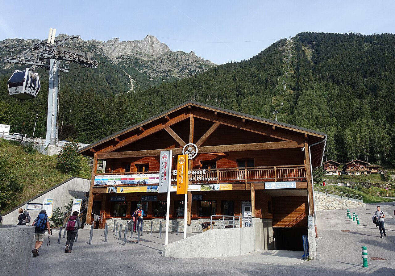
The wooden Planpraz gondola boarding station in Chamonix, with cabins climbing the hillside behind
The Planpraz boarding station in Chamonix. This summer photograph shows where the Brévent outing starts, rather than the ski runs.August 2019 · Starting areaTiia Monto / Wikimedia Commons · CC BY-SA 3.0 · Full photo · Resized only
Start here

Planpraz gondola

29 route Henriette d’Angeville, Chamonix, France

Choosing a hotel or apartment? Enter its address as the starting point in walking directions, then check the route to this lift.

The pin is at the bottom station in Chamonix, not the upper Planpraz station.

Map © OpenStreetMap contributors. The pin shows where to board the lift.

Take Planpraz up from Chamonix. Blanchots and Vioz are in the Parsa area; you do not need the separate Brévent summit cable car.

Arriving by car: Parking du Brévent, Clos des Châblettes. Parking details ↗

The last walk.

  • About 150 m3–5 min in ski boots

    Parking du Brévent → Planpraz gondola

    Follow the pedestrian signs to Planpraz. The walk varies with the parking floor and exit you use.

    See the walking route ↗
  • About 120 m2–3 min in ski boots

    Le Brévent bus stop → Planpraz gondola

    Take the pedestrian approach south from the stop to the gondola entrance.

    See the walking route ↗
Map estimates & sources

Map estimate from an OpenStreetMap walking route. Distance is rounded; time allows for ski boots and excludes queues.

Parking du Brévent · access information ↗ · Checked 2026-10-24

Le Brévent bus stop · access information ↗ · Checked 2026-10-24

Add your starting point and travel date in Google Maps. Check the last local connection and lift back down.

Start here · Chamonix / Planpraz

Planpraz gondola

Starting-lift map & hotel walk ↓

Linking turns; a mountain blue circuit

Lift up & get to the run
Planpraz gondola from Chamonix → follow Vioz to the Parsa chair. You do not need the Brévent summit cable car.
Repeat or get home
Take Parsa for another lap. To finish, use the green Retour Planpraz connection and take Planpraz gondola down to Chamonix.

Watch for. The lift above Planpraz to the Brévent summit serves black Charles Bozon. Keep Parsa and Planpraz as your landmarks for this blue-run session.

Full Vioz run guide →
View my trip →Saved on this browser. An account is optional.
Route sources · 2026-10-24

Video identity / embed review: 2026-11-11. A creator’s footage shows that visit, rather than today’s snow or lift operation.

Official blue

Blanchots

Come for the high mountain setting, but make Blanchots a progression run rather than your first experiment with blue pistes. It sits in Brévent’s Parsa sector below Planpraz, where you can repeat a chairlift circuit and finish by gondola instead of adding a difficult descent to town.

Run video
Blue piste Blanchots Le Brévent, Chamonix-Mont-Blanc | Piste View — Piste View Original on YouTube ↗

Published 2018-02-23; filming date not supplied. This is the named Blanchots run at Brévent. Use it to assess a progression blue, rather than treating the official colour as a first-blue recommendation. Public player metadata and embedding were checked 11 November 2026.

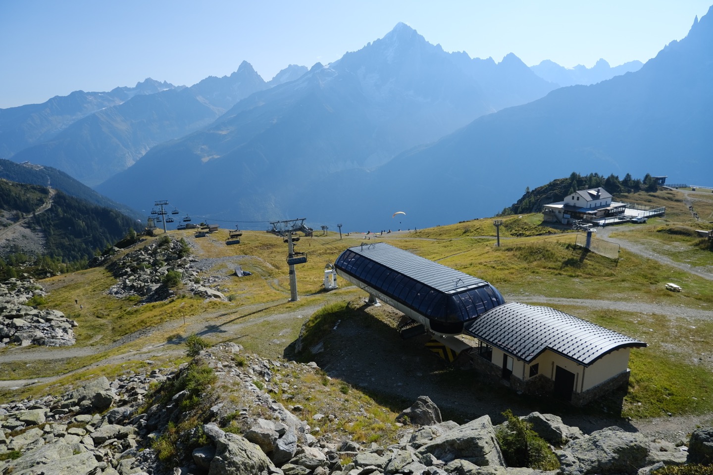
Chairlift station and mountain buildings in the Planpraz area, with Mont Blanc across the valley in summer
The upper Planpraz area in summer, to help place the mountain setting. An orientation photograph, not a preview of Blanchots or winter conditions; resized with the full frame retained.18 September 2020 · Starting areaGuilhem Vellut / Wikimedia Commons · CC BY 2.0 · Full photo · Resized only
Start here

Planpraz gondola

29 route Henriette d’Angeville, Chamonix, France

Choosing a hotel or apartment? Enter its address as the starting point in walking directions, then check the route to this lift.

The pin is at the bottom station in Chamonix, not the upper Planpraz station.

Map © OpenStreetMap contributors. The pin shows where to board the lift.

Take Planpraz up from Chamonix. Blanchots and Vioz are in the Parsa area; you do not need the separate Brévent summit cable car.

Arriving by car: Parking du Brévent, Clos des Châblettes. Parking details ↗

The last walk.

  • About 150 m3–5 min in ski boots

    Parking du Brévent → Planpraz gondola

    Follow the pedestrian signs to Planpraz. The walk varies with the parking floor and exit you use.

    See the walking route ↗
  • About 120 m2–3 min in ski boots

    Le Brévent bus stop → Planpraz gondola

    Take the pedestrian approach south from the stop to the gondola entrance.

    See the walking route ↗
Map estimates & sources

Map estimate from an OpenStreetMap walking route. Distance is rounded; time allows for ski boots and excludes queues.

Parking du Brévent · access information ↗ · Checked 2026-10-24

Le Brévent bus stop · access information ↗ · Checked 2026-10-24

Add your starting point and travel date in Google Maps. Check the last local connection and lift back down.

Start here · Chamonix / Planpraz

Planpraz gondola

Starting-lift map & hotel walk ↓

Ready to move beyond easier blues

Lift up & get to the run
Planpraz gondola → Parsa sector; Plateau 2000 is a separate warm-up option.
Repeat or get home
Green Retour Planpraz → upper gondola station → ride down to Chamonix.

Watch for. The cable car above Planpraz leads to the Brévent summit, where the map marks the Charles Bozon descent black. Do not follow a group onto that extra lift assuming you are still on the Blanchots blue circuit. For this plan, keep Planpraz and Parsa as your reference points.

Full Blanchots run guide →
View my trip →Saved on this browser. An account is optional.
Route sources · 2026-10-21

Video identity / embed review: 2026-11-11. A creator’s footage shows that visit, rather than today’s snow or lift operation.

The last walk matters.

Book around the lift you want to use.

Want to skip the daily ski bus?

A property with a workable winter walk to Prarion or Planpraz can support a local Chamonix day without a morning bus. Compare those starts with Les Gets, Avoriaz and the Grand Massif before booking; a whole valley or linked region is not one shared snow front.

Compare eight specific walk-to-lift bases →

For La Cha and Chamois, stay near Prarion

Put 117 Place du Prarion, Les Houches into your accommodation check. A property described as being in Chamonix may still need a valley journey to this gondola. Bellevue is a separate boarding point at 77 Place de la Fruitière; it is not the start of these two lap plans.

Prarion address, parking and current bus links ↗

For Vioz and Blanchots, check the walk to Planpraz

Planpraz departs from 29 Route Henriette d'Angeville in Chamonix. Check the actual walking route from your hotel, especially with children and ski boots. The gondola reaches Planpraz; the separate summit cable car is outside this blue-run plan.

Planpraz address, facilities and current bus links ↗

Settle the downhill cabin before the first lap

Ask lift staff about downhill passenger arrangements and the last descent before going up. The return plans use the gondola, so leave time to regain the upper station. Do not follow another group onto a lower red or black descent when your own plan is to ride down.

Check with the lift operator ↗

Stays near the starting bases →

Before you choose your ski day.

Which blue runs should I try in Chamonix?

For a repeatable Les Houches outing, compare La Cha and Chamois from Prarion, with laps on Mélèzes. Above Chamonix town, Vioz and Blanchots use the Planpraz / Parsa sector. All four are officially blue, but none is a promise of nursery-slope difficulty: watch the exact-run footage and choose for your current ability and the day's conditions.

Is Chamonix suitable for complete beginners?

There are separate learning areas, including Le Savoy in town, La Vormaine at Le Tour and Plateau 2000 reached by Planpraz. Prarion also has a carpet and school chair. Start with the nursery-slope guide if you are still learning to stop and link turns; this shortlist is for the later move onto mountain blues.

Can I finish these outings without skiing a hard run to the village?

The Les Houches plan returns uphill on Mélèzes towards Prarion and finishes by gondola. The Brévent plan returns via the green Retour Planpraz connection and finishes by Planpraz gondola. Confirm downhill passengers and last descent with staff that morning. La Cha and Chamois do not imply an all-blue descent down the lower red slopes.

Should I book in Les Houches or Chamonix town?

Choose the morning lift first. Prarion in Les Houches serves the La Cha / Chamois outing; Planpraz in Chamonix serves Vioz / Blanchots. Compare your hotel's actual door-to-lift walking route and the current valley bus before booking. Neither a central Chamonix address nor a general 'ski resort' label guarantees a short walk to Prarion.

Do the pictures and videos show today's conditions?

No. The photos are credited archive images, with dates and whether they show a ski area or a starting point. Each video identifies a named run; the creator-page and embedding checks do not guarantee current grooming, visibility or snow. Check the operator's live opening information before skiing.

How we chose these blues.

Four source-linked blue outings in two separate valley sectors, with exact-run creator videos and a passenger-gondola finish. Official maps support each approach and return; archive photographs identify their actual area and reuse licence.

Original route-review dates stay with each run. Filming or publication dates appear beside each video; photographs retain their source, author, licence and capture date. A resort view or starting-area photo is labelled separately from a photograph of the named piste.

Official planning links · checked 2026-11-11